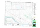
Maps showing Fielding, 8-41-11-W3, Saskatchewan
Fielding is a Unincorporated area located in 8-41-11-W3, Saskatchewan and has an elevation of 549 meters.
- Latitude: 52° 31' North (decimal: 52.5167237)
- Longitude: 107° 32' West (decimal: -107.5339711)
- Topography Feature Category: Unincorporated area
- Geographical Feature: Hamlet
- Canadian Province/Territory: Saskatchewan
- Elevation: 549 meters
- Location: 8-41-11-W3
- Atlas of Canada Locator Map: Fielding
- GPS Coordinate Locator Map: Fielding Lat/Long