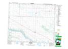
Maps showing Ruddell, 7-42-13-W3, Saskatchewan
Ruddell is a Village located in 7-42-13-W3, Saskatchewan and has an elevation of 574 meters.
- Latitude: 52° 36' 19'' North (decimal: 52.6052694)
- Longitude: 107° 51' 28'' West (decimal: -107.8578694)
- Topography Feature Category: Village
- Geographical Feature: Village
- Canadian Province/Territory: Saskatchewan
- Elevation: 574 meters
- Location: 7-42-13-W3
- Atlas of Canada Locator Map: Ruddell
- GPS Coordinate Locator Map: Ruddell Lat/Long