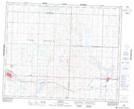
Maps showing Perdue, 32-35-11-W3, Saskatchewan
Perdue is a Village located in 32-35-11-W3, Saskatchewan and has an elevation of 550 meters.
- Latitude: 52° 3' 15'' North (decimal: 52.0541083)
- Longitude: 107° 32' 41'' West (decimal: -107.5448528)
- Topography Feature Category: Village
- Geographical Feature: Village
- Canadian Province/Territory: Saskatchewan
- Elevation: 550 meters
- Location: 32-35-11-W3
- Atlas of Canada Locator Map: Perdue
- GPS Coordinate Locator Map: Perdue Lat/Long