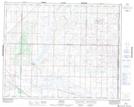
Maps showing Blucher, 15-35-2-W3, Saskatchewan
Blucher is a Unincorporated area located in 15-35-2-W3, Saskatchewan and has an elevation of 518 meters.
- Latitude: 52° 1' North (decimal: 52.0167038)
- Longitude: 106° 12' West (decimal: -106.2005986)
- Topography Feature Category: Unincorporated area
- Geographical Feature: Hamlet
- Canadian Province/Territory: Saskatchewan
- Elevation: 518 meters
- Location: 15-35-2-W3
- Atlas of Canada Locator Map: Blucher
- GPS Coordinate Locator Map: Blucher Lat/Long