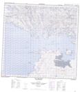
Maps showing Poplar Point, Saskatchewan
Poplar Point is a Cape located in Saskatchewan and has an elevation of 232 meters.
- Latitude: 59° 20' North (decimal: 59.3336922)
- Longitude: 107° 48' West (decimal: -107.8010162)
- Topography Feature Category: Cape
- Geographical Feature: Point
- Canadian Province/Territory: Saskatchewan
- Elevation: 232 meters
- Atlas of Canada Locator Map: Poplar Point
- GPS Coordinate Locator Map: Poplar Point Lat/Long
Poplar Point NTS Map Sheets