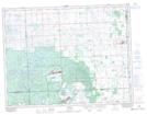
Maps showing Wawota, 13-11-1-W2, Saskatchewan
Wawota is a Town located in 13-11-1-W2, Saskatchewan and has an elevation of 644 meters.
- Latitude: 49° 54' 24'' North (decimal: 49.9065416)
- Longitude: 102° 1' 34'' West (decimal: -102.0262222)
- Topography Feature Category: Town
- Geographical Feature: Town
- Canadian Province/Territory: Saskatchewan
- Elevation: 644 meters
- Location: 13-11-1-W2
- Atlas of Canada Locator Map: Wawota
- GPS Coordinate Locator Map: Wawota Lat/Long