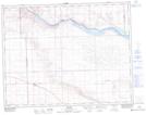
Maps showing Wayne Creek, 21-21-20-W3, Saskatchewan
Wayne Creek is a River located in 21-21-20-W3, Saskatchewan and has an elevation of 654 meters.
- Latitude: 50° 48' North (decimal: 50.8000465)
- Longitude: 108° 43' West (decimal: -108.7173825)
- Topography Feature Category: River
- Geographical Feature: Creek
- Canadian Province/Territory: Saskatchewan
- Elevation: 654 meters
- Location: 21-21-20-W3
- Atlas of Canada Locator Map: Wayne Creek
- GPS Coordinate Locator Map: Wayne Creek Lat/Long