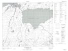
Maps showing Wert Creek, 68-18-W2, Saskatchewan
Wert Creek is a River located in 68-18-W2, Saskatchewan.
- Latitude: 54° 52' North (decimal: 54.8667301)
- Longitude: 104° 42' West (decimal: -104.7004358)
- Topography Feature Category: River
- Geographical Feature: Creek
- Canadian Province/Territory: Saskatchewan
- Location: 68-18-W2
- Atlas of Canada Locator Map: Wert Creek
- GPS Coordinate Locator Map: Wert Creek Lat/Long
Wert Creek NTS Map Sheets