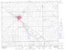
Maps showing Weyburn, Saskatchewan
Weyburn is a City located in Saskatchewan and has an elevation of 569 meters.
- Latitude: 49° 39' 40'' North (decimal: 49.6609833)
- Longitude: 103° 51' 9'' West (decimal: -103.8526306)
- Topography Feature Category: City
- Geographical Feature: City
- Canadian Province/Territory: Saskatchewan
- Elevation: 569 meters
- Atlas of Canada Locator Map: Weyburn
- GPS Coordinate Locator Map: Weyburn Lat/Long
Weyburn NTS Map Sheets