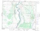
Maps showing Whitecap, Saskatchewan
Whitecap is a Unincorporated area located in Saskatchewan and has an elevation of 483 meters.
- Latitude: 51° 52' North (decimal: 51.8667081)
- Longitude: 106° 42' West (decimal: -106.7006194)
- Topography Feature Category: Unincorporated area
- Geographical Feature: Locality
- Canadian Province/Territory: Saskatchewan
- Elevation: 483 meters
- Atlas of Canada Locator Map: Whitecap
- GPS Coordinate Locator Map: Whitecap Lat/Long