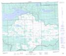
Maps showing Whitefish Point, 15-63-23-W3, Saskatchewan
Whitefish Point is a Cape located in 15-63-23-W3, Saskatchewan and has an elevation of 499 meters.
- Latitude: 54° 27' North (decimal: 54.4500917)
- Longitude: 109° 24' West (decimal: -109.4007965)
- Topography Feature Category: Cape
- Geographical Feature: Point
- Canadian Province/Territory: Saskatchewan
- Elevation: 499 meters
- Location: 15-63-23-W3
- Atlas of Canada Locator Map: Whitefish Point
- GPS Coordinate Locator Map: Whitefish Point Lat/Long
Whitefish Point NTS Map Sheets