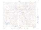
Maps showing Beaubier, 16-2-16-W2, Saskatchewan
Beaubier is a Hamlet located in 16-2-16-W2, Saskatchewan and has an elevation of 702 meters.
- Latitude: 49° 7' 36'' North (decimal: 49.1266277)
- Longitude: 104° 4' 46'' West (decimal: -104.0794360)
- Topography Feature Category: Hamlet
- Geographical Feature: Organized Hamlet
- Canadian Province/Territory: Saskatchewan
- Elevation: 702 meters
- Location: 16-2-16-W2
- Atlas of Canada Locator Map: Beaubier
- GPS Coordinate Locator Map: Beaubier Lat/Long
Beaubier NTS Map Sheets