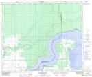
Maps showing Pemmican Point, 53-12-W2, Saskatchewan
Pemmican Point is a Cape located in 53-12-W2, Saskatchewan and has an elevation of 327 meters.
- Latitude: 53° 33' North (decimal: 53.5500468)
- Longitude: 103° 40' West (decimal: -103.6671174)
- Topography Feature Category: Cape
- Geographical Feature: Point
- Canadian Province/Territory: Saskatchewan
- Elevation: 327 meters
- Location: 53-12-W2
- Atlas of Canada Locator Map: Pemmican Point
- GPS Coordinate Locator Map: Pemmican Point Lat/Long
Pemmican Point NTS Map Sheets