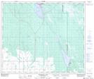
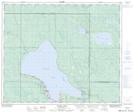
Maps showing Candle Lake, 18-55-22-W2, Saskatchewan
Candle Lake is a Village located in 18-55-22-W2, Saskatchewan and has an elevation of 503 meters.
- Latitude: 53° 47' 7'' North (decimal: 53.7853011)
- Longitude: 105° 15' 25'' West (decimal: -105.2570583)
- Topography Feature Category: Village
- Geographical Feature: Resort Village
- Canadian Province/Territory: Saskatchewan
- Elevation: 503 meters
- Location: 18-55-22-W2
- Atlas of Canada Locator Map: Candle Lake
- GPS Coordinate Locator Map: Candle Lake Lat/Long
Candle Lake NTS Map Sheets