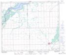
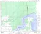
Maps showing Petaigan River, 15-52-11-W2, Saskatchewan
Petaigan River is a River located in 15-52-11-W2, Saskatchewan and has an elevation of 313 meters.
- Latitude: 53° 30' North (decimal: 53.5000448)
- Longitude: 103° 33' West (decimal: -103.5504524)
- Topography Feature Category: River
- Geographical Feature: River
- Canadian Province/Territory: Saskatchewan
- Elevation: 313 meters
- Location: 15-52-11-W2
- Atlas of Canada Locator Map: Petaigan River
- GPS Coordinate Locator Map: Petaigan River Lat/Long
Petaigan River NTS Map Sheets