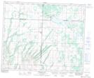
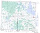
Maps showing Avery, 28-49-14-W3, Saskatchewan
Avery is a Unincorporated area located in 28-49-14-W3, Saskatchewan and has an elevation of 685 meters.
- Latitude: 53° 15' North (decimal: 53.2500738)
- Longitude: 107° 59' West (decimal: -107.9839806)
- Topography Feature Category: Unincorporated area
- Geographical Feature: Railway Point
- Canadian Province/Territory: Saskatchewan
- Elevation: 685 meters
- Location: 28-49-14-W3
- Atlas of Canada Locator Map: Avery
- GPS Coordinate Locator Map: Avery Lat/Long
Avery NTS Map Sheets