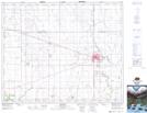
Maps showing Thaxted, 18-46-18-W2, Saskatchewan
Thaxted is a Unincorporated area located in 18-46-18-W2, Saskatchewan and has an elevation of 434 meters.
- Latitude: 52° 58' North (decimal: 52.9666801)
- Longitude: 104° 36' West (decimal: -104.6004830)
- Topography Feature Category: Unincorporated area
- Geographical Feature: Locality
- Canadian Province/Territory: Saskatchewan
- Elevation: 434 meters
- Location: 18-46-18-W2
- Atlas of Canada Locator Map: Thaxted
- GPS Coordinate Locator Map: Thaxted Lat/Long