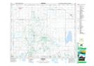
Maps showing Birch Hills, 21-46-24-W2, Saskatchewan
Birch Hills is a Town located in 21-46-24-W2, Saskatchewan and has an elevation of 467 meters.
- Latitude: 52° 59' 3'' North (decimal: 52.9840353)
- Longitude: 105° 25' 57'' West (decimal: -105.4325193)
- Topography Feature Category: Town
- Geographical Feature: Town
- Canadian Province/Territory: Saskatchewan
- Elevation: 467 meters
- Location: 21-46-24-W2
- Atlas of Canada Locator Map: Birch Hills
- GPS Coordinate Locator Map: Birch Hills Lat/Long