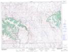
Maps showing Whites Coulee, 8,9-27-W3, Saskatchewan
Whites Coulee is a Valley located in 8,9-27-W3, Saskatchewan and has an elevation of 1144 meters.
- Latitude: 49° 42' North (decimal: 49.7000339)
- Longitude: 109° 33' West (decimal: -109.5507511)
- Topography Feature Category: Valley
- Geographical Feature: Coulee
- Canadian Province/Territory: Saskatchewan
- Elevation: 1144 meters
- Location: 8,9-27-W3
- Atlas of Canada Locator Map: Whites Coulee
- GPS Coordinate Locator Map: Whites Coulee Lat/Long
Whites Coulee NTS Map Sheets