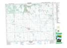
Maps showing Whitewood, 7-16-2-W2, Saskatchewan
Whitewood is a Town located in 7-16-2-W2, Saskatchewan and has an elevation of 602 meters.
- Latitude: 50° 19' 52'' North (decimal: 50.3311527)
- Longitude: 102° 16' 11'' West (decimal: -102.2698528)
- Topography Feature Category: Town
- Geographical Feature: Town
- Canadian Province/Territory: Saskatchewan
- Elevation: 602 meters
- Location: 7-16-2-W2
- Atlas of Canada Locator Map: Whitewood
- GPS Coordinate Locator Map: Whitewood Lat/Long