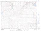
Maps showing Consul, 13-4-27-W3, Saskatchewan
Consul is a Village located in 13-4-27-W3, Saskatchewan and has an elevation of 919 meters.
- Latitude: 49° 17' 40'' North (decimal: 49.2943888)
- Longitude: 109° 31' 13'' West (decimal: -109.5202581)
- Topography Feature Category: Village
- Geographical Feature: Village
- Canadian Province/Territory: Saskatchewan
- Elevation: 919 meters
- Location: 13-4-27-W3
- Atlas of Canada Locator Map: Consul
- GPS Coordinate Locator Map: Consul Lat/Long
Consul NTS Map Sheets