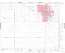
Maps showing Arnheim Place, Saskatchewan
Arnheim Place is a Unincorporated area located in Saskatchewan and has an elevation of 563 meters.
- Latitude: 50° 26' 11'' North (decimal: 50.4364288)
- Longitude: 104° 35' 12'' West (decimal: -104.5866589)
- Topography Feature Category: Unincorporated area
- Geographical Feature: Urban Community
- Canadian Province/Territory: Saskatchewan
- Elevation: 563 meters
- Atlas of Canada Locator Map: Arnheim Place
- GPS Coordinate Locator Map: Arnheim Place Lat/Long