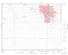
Maps showing Pioneer Village, Saskatchewan
Pioneer Village is a Unincorporated area located in Saskatchewan and has an elevation of 559 meters.
- Latitude: 50° 27' 6'' North (decimal: 50.4517069)
- Longitude: 104° 38' 54'' West (decimal: -104.6483276)
- Topography Feature Category: Unincorporated area
- Geographical Feature: Urban Community
- Canadian Province/Territory: Saskatchewan
- Elevation: 559 meters
- Atlas of Canada Locator Map: Pioneer Village
- GPS Coordinate Locator Map: Pioneer Village Lat/Long