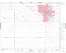
Maps showing Tuxedo Park, Saskatchewan
Tuxedo Park is a Unincorporated area located in Saskatchewan and has an elevation of 572 meters.
- Latitude: 50° 27' 4'' North (decimal: 50.4511510)
- Longitude: 104° 34' 44'' West (decimal: -104.5788806)
- Topography Feature Category: Unincorporated area
- Geographical Feature: Urban Community
- Canadian Province/Territory: Saskatchewan
- Elevation: 572 meters
- Atlas of Canada Locator Map: Tuxedo Park
- GPS Coordinate Locator Map: Tuxedo Park Lat/Long