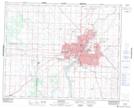
Maps showing Albert, Saskatchewan
Albert is a Unincorporated area located in Saskatchewan and has an elevation of 489 meters.
- Latitude: 52° 7' 4'' North (decimal: 52.1178212)
- Longitude: 106° 38' 41'' West (decimal: -106.6447779)
- Topography Feature Category: Unincorporated area
- Geographical Feature: Urban Community
- Canadian Province/Territory: Saskatchewan
- Elevation: 489 meters
- Atlas of Canada Locator Map: Albert
- GPS Coordinate Locator Map: Albert Lat/Long
Albert NTS Map Sheets