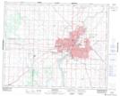
Maps showing Industrial, Saskatchewan
Industrial is a Unincorporated area located in Saskatchewan and has an elevation of 497 meters.
- Latitude: 52° 7' 55'' North (decimal: 52.1319872)
- Longitude: 106° 35' 32'' West (decimal: -106.5922753)
- Topography Feature Category: Unincorporated area
- Geographical Feature: Industrial Area
- Canadian Province/Territory: Saskatchewan
- Elevation: 497 meters
- Atlas of Canada Locator Map: Industrial
- GPS Coordinate Locator Map: Industrial Lat/Long
Industrial NTS Map Sheets