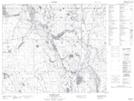
Maps showing Beaver Creek, Saskatchewan
Beaver Creek is a River located in Saskatchewan and has an elevation of 554 meters.
- Latitude: 54° 3' North (decimal: 54.0500573)
- Longitude: 104° 38' West (decimal: -104.6337692)
- Topography Feature Category: River
- Geographical Feature: Creek
- Canadian Province/Territory: Saskatchewan
- Elevation: 554 meters
- GPS Coordinate Locator Map: Beaver Creek Lat/Long
Beaver Creek NTS Map Sheets