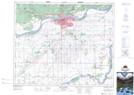
Maps showing Miller's Hill, 19,20-48-25-W2; 24-48-26-W2, Saskatchewan
Miller's Hill is a Unincorporated area located in 19,20-48-25-W2; 24-48-26-W2, Saskatchewan and has an elevation of 427 meters.
- Latitude: 53° 12' North (decimal: 53.2000365)
- Longitude: 105° 40' West (decimal: -105.6671724)
- Topography Feature Category: Unincorporated area
- Geographical Feature: Hamlet
- Canadian Province/Territory: Saskatchewan
- Elevation: 427 meters
- Location: 19,20-48-25-W2; 24-48-26-W2
- Atlas of Canada Locator Map: Miller's Hill
- GPS Coordinate Locator Map: Miller's Hill Lat/Long
Miller's Hill NTS Map Sheets