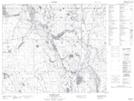
Maps showing Summit Lake, 60-19-W2, Saskatchewan
Summit Lake is a Lake located in 60-19-W2, Saskatchewan and has an elevation of 547 meters.
- Latitude: 54° 9' North (decimal: 54.1500561)
- Longitude: 104° 44' West (decimal: -104.7337731)
- Topography Feature Category: Lake
- Geographical Feature: Lake
- Canadian Province/Territory: Saskatchewan
- Elevation: 547 meters
- Location: 60-19-W2
- Atlas of Canada Locator Map: Summit Lake
- GPS Coordinate Locator Map: Summit Lake Lat/Long
Summit Lake NTS Map Sheets