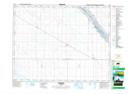
Maps showing Tuxford, 5-19-26-W2, Saskatchewan
Tuxford is a Village located in 5-19-26-W2, Saskatchewan and has an elevation of 562 meters.
- Latitude: 50° 34' 31'' North (decimal: 50.5753361)
- Longitude: 105° 34' 50'' West (decimal: -105.5805416)
- Topography Feature Category: Village
- Geographical Feature: Village
- Canadian Province/Territory: Saskatchewan
- Elevation: 562 meters
- Location: 5-19-26-W2
- Atlas of Canada Locator Map: Tuxford
- GPS Coordinate Locator Map: Tuxford Lat/Long