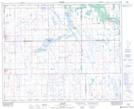
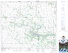
Maps showing Lac Vert, 2-41-18-W2, Saskatchewan
Lac Vert is a Hamlet located in 2-41-18-W2, Saskatchewan and has an elevation of 548 meters.
- Latitude: 52° 30' North (decimal: 52.5000098)
- Longitude: 104° 29' West (decimal: -104.4838403)
- Topography Feature Category: Hamlet
- Geographical Feature: Hamlet
- Canadian Province/Territory: Saskatchewan
- Elevation: 548 meters
- Location: 2-41-18-W2
- Atlas of Canada Locator Map: Lac Vert
- GPS Coordinate Locator Map: Lac Vert Lat/Long
Lac Vert NTS Map Sheets