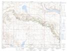
Maps showing Twin Valley, 30-4-29-W2, Saskatchewan
Twin Valley is a Unincorporated area located in 30-4-29-W2, Saskatchewan and has an elevation of 824 meters.
- Latitude: 49° 20' North (decimal: 49.3333619)
- Longitude: 105° 54' West (decimal: -105.9005723)
- Topography Feature Category: Unincorporated area
- Geographical Feature: Locality
- Canadian Province/Territory: Saskatchewan
- Elevation: 824 meters
- Location: 30-4-29-W2
- Atlas of Canada Locator Map: Twin Valley
- GPS Coordinate Locator Map: Twin Valley Lat/Long
Twin Valley NTS Map Sheets