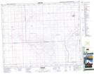
Maps showing Tyner Coulee, 23,24-18-W3, Saskatchewan
Tyner Coulee is a Valley located in 23,24-18-W3, Saskatchewan and has an elevation of 595 meters.
- Latitude: 51° 0' North (decimal: 51.0000463)
- Longitude: 108° 27' West (decimal: -108.4507060)
- Topography Feature Category: Valley
- Geographical Feature: Coulee
- Canadian Province/Territory: Saskatchewan
- Elevation: 595 meters
- Location: 23,24-18-W3
- Atlas of Canada Locator Map: Tyner Coulee
- GPS Coordinate Locator Map: Tyner Coulee Lat/Long