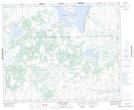
Maps showing Yonker, 27-42-26-W3, Saskatchewan
Yonker is a Unincorporated area located in 27-42-26-W3, Saskatchewan.
- Latitude: 52° 39' North (decimal: 52.6500749)
- Longitude: 109° 40' West (decimal: -109.6674209)
- Topography Feature Category: Unincorporated area
- Geographical Feature: Railway Point
- Canadian Province/Territory: Saskatchewan
- Location: 27-42-26-W3
- Atlas of Canada Locator Map: Yonker
- GPS Coordinate Locator Map: Yonker Lat/Long
Yonker NTS Map Sheets