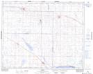
Maps showing Zelma Reservoir, 33-27-,28-W2, Saskatchewan
Zelma Reservoir is a Lake located in 33-27-,28-W2, Saskatchewan and has an elevation of 520 meters.
- Latitude: 51° 50' North (decimal: 51.8333676)
- Longitude: 105° 50' West (decimal: -105.8339298)
- Topography Feature Category: Lake
- Geographical Feature: Reservoir
- Canadian Province/Territory: Saskatchewan
- Elevation: 520 meters
- Location: 33-27-,28-W2
- Atlas of Canada Locator Map: Zelma Reservoir
- GPS Coordinate Locator Map: Zelma Reservoir Lat/Long