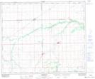
Maps showing Zenon Park, 19-47-12-W2, Saskatchewan
Zenon Park is a Village located in 19-47-12-W2, Saskatchewan and has an elevation of 386 meters.
- Latitude: 53° 3' 50'' North (decimal: 53.0638610)
- Longitude: 103° 45' 29'' West (decimal: -103.7580221)
- Topography Feature Category: Village
- Geographical Feature: Village
- Canadian Province/Territory: Saskatchewan
- Elevation: 386 meters
- Location: 19-47-12-W2
- Atlas of Canada Locator Map: Zenon Park
- GPS Coordinate Locator Map: Zenon Park Lat/Long
Zenon Park NTS Map Sheets