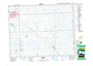
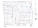
Maps showing Yorkton, Saskatchewan
Yorkton is a City located in Saskatchewan and has an elevation of 502 meters.
- Latitude: 51° 12' 50'' North (decimal: 51.2137749)
- Longitude: 102° 27' 46'' West (decimal: -102.4628806)
- Topography Feature Category: City
- Geographical Feature: City
- Canadian Province/Territory: Saskatchewan
- Elevation: 502 meters
- Atlas of Canada Locator Map: Yorkton
- GPS Coordinate Locator Map: Yorkton Lat/Long
Yorkton NTS Map Sheets