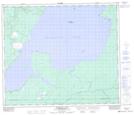
Maps showing Backes Island Wildlife Refuge, Saskatchewan
Backes Island Wildlife Refuge is a Conservation area located in Saskatchewan and has an elevation of 602 meters.
- Latitude: 54° 58' North (decimal: 54.9667502)
- Longitude: 109° 42' West (decimal: -109.7008334)
- Topography Feature Category: Conservation area
- Geographical Feature: Wildlife Refuge
- Canadian Province/Territory: Saskatchewan
- Elevation: 602 meters
- Atlas of Canada Locator Map: Backes Island Wildlife Refuge
- GPS Coordinate Locator Map: Backes Island Wildlife Refuge Lat/Long
Backes Island Wildlife Refuge NTS Map Sheets