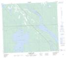
Maps showing Gatehouse Island Wildlife Refuge, Saskatchewan
Gatehouse Island Wildlife Refuge is a Conservation area located in Saskatchewan.
- Latitude: 55° 35' North (decimal: 55.5834168)
- Longitude: 108° 21' West (decimal: -108.3507125)
- Topography Feature Category: Conservation area
- Geographical Feature: Wildlife Refuge
- Canadian Province/Territory: Saskatchewan
- Atlas of Canada Locator Map: Gatehouse Island Wildlife Refuge
- GPS Coordinate Locator Map: Gatehouse Island Wildlife Refuge Lat/Long
Gatehouse Island Wildlife Refuge NTS Map Sheets