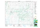
Maps showing Lenore Lake Wildlife Refuge, Saskatchewan
Lenore Lake Wildlife Refuge is a Conservation area located in Saskatchewan.
- Latitude: 52° 32' North (decimal: 52.5333513)
- Longitude: 104° 57' West (decimal: -104.9505241)
- Topography Feature Category: Conservation area
- Geographical Feature: Wildlife Refuge
- Canadian Province/Territory: Saskatchewan
- Atlas of Canada Locator Map: Lenore Lake Wildlife Refuge
- GPS Coordinate Locator Map: Lenore Lake Wildlife Refuge Lat/Long