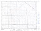
Maps showing Osage Wildlife Refuge, Saskatchewan
Osage Wildlife Refuge is a Conservation area located in Saskatchewan.
- Latitude: 49° 56' North (decimal: 49.9333551)
- Longitude: 103° 33' West (decimal: -103.5505367)
- Topography Feature Category: Conservation area
- Geographical Feature: Wildlife Refuge
- Canadian Province/Territory: Saskatchewan
- Atlas of Canada Locator Map: Osage Wildlife Refuge
- GPS Coordinate Locator Map: Osage Wildlife Refuge Lat/Long