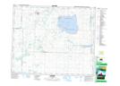
Maps showing Redberry Wildlife Refuge, Saskatchewan
Redberry Wildlife Refuge is a Conservation area located in Saskatchewan.
- Latitude: 52° 42' North (decimal: 52.7000563)
- Longitude: 107° 12' West (decimal: -107.2006107)
- Topography Feature Category: Conservation area
- Geographical Feature: Wildlife Refuge
- Canadian Province/Territory: Saskatchewan
- Atlas of Canada Locator Map: Redberry Wildlife Refuge
- GPS Coordinate Locator Map: Redberry Wildlife Refuge Lat/Long