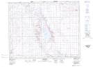
Maps showing Mantario Wildlife Management Unit, Saskatchewan
Mantario Wildlife Management Unit is a Conservation area located in Saskatchewan.
- Latitude: 51° 10' North (decimal: 51.1667281)
- Longitude: 109° 55' West (decimal: -109.9174668)
- Topography Feature Category: Conservation area
- Geographical Feature: Wildlife Management Unit
- Canadian Province/Territory: Saskatchewan
- Atlas of Canada Locator Map: Mantario Wildlife Management Unit
- GPS Coordinate Locator Map: Mantario Wildlife Management Unit Lat/Long
Mantario Wildlife Management Unit NTS Map Sheets