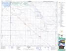
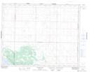
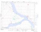
Maps showing Douglas Provincial Park, 23-24-4-W3, Saskatchewan
Douglas Provincial Park is a Conservation area located in 23-24-4-W3, Saskatchewan and has an elevation of 557 meters.
- Latitude: 51° 0' 58'' North (decimal: 51.0160302)
- Longitude: 106° 27' 58'' West (decimal: -106.4662080)
- Topography Feature Category: Conservation area
- Geographical Feature: Provincial Park
- Canadian Province/Territory: Saskatchewan
- Elevation: 557 meters
- Location: 23-24-4-W3
- Atlas of Canada Locator Map: Douglas Provincial Park
- GPS Coordinate Locator Map: Douglas Provincial Park Lat/Long
Douglas Provincial Park NTS Map Sheets