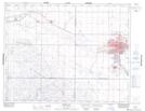
Maps showing Besant Recreation Site, 29-17-29-W2, Saskatchewan
Besant Recreation Site is a Conservation area located in 29-17-29-W2, Saskatchewan and has an elevation of 578 meters.
- Latitude: 50° 27' 49'' North (decimal: 50.4635889)
- Longitude: 105° 57' 42'' West (decimal: -105.9616761)
- Topography Feature Category: Conservation area
- Geographical Feature: Recreation Site
- Canadian Province/Territory: Saskatchewan
- Elevation: 578 meters
- Location: 29-17-29-W2
- Atlas of Canada Locator Map: Besant Recreation Site
- GPS Coordinate Locator Map: Besant Recreation Site Lat/Long