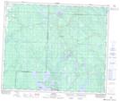
Maps showing Chitek Lake Recreation Site, 55-12-W3, Saskatchewan
Chitek Lake Recreation Site is a Conservation area located in 55-12-W3, Saskatchewan and has an elevation of 563 meters.
- Latitude: 53° 45' 49'' North (decimal: 53.7636164)
- Longitude: 107° 46' 39'' West (decimal: -107.7774583)
- Topography Feature Category: Conservation area
- Geographical Feature: Recreation Site
- Canadian Province/Territory: Saskatchewan
- Elevation: 563 meters
- Location: 55-12-W3
- Atlas of Canada Locator Map: Chitek Lake Recreation Site
- GPS Coordinate Locator Map: Chitek Lake Recreation Site Lat/Long