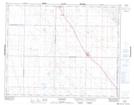
Maps showing Kenaston Recreation Site, 17-29-2-W3, Saskatchewan
Kenaston Recreation Site is a Conservation area located in 17-29-2-W3, Saskatchewan and has an elevation of 614 meters.
- Latitude: 51° 28' 30'' North (decimal: 51.4750322)
- Longitude: 106° 15' 11'' West (decimal: -106.2531073)
- Topography Feature Category: Conservation area
- Geographical Feature: Recreation Site
- Canadian Province/Territory: Saskatchewan
- Elevation: 614 meters
- Location: 17-29-2-W3
- Atlas of Canada Locator Map: Kenaston Recreation Site
- GPS Coordinate Locator Map: Kenaston Recreation Site Lat/Long