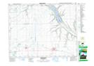
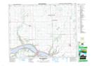
Maps showing Lebret Recreation Site, Saskatchewan
Lebret Recreation Site is a Conservation area located in Saskatchewan.
- Latitude: 50° 45' 14'' North (decimal: 50.7540013)
- Longitude: 103° 42' 15'' West (decimal: -103.7041207)
- Topography Feature Category: Conservation area
- Geographical Feature: Recreation Site
- Canadian Province/Territory: Saskatchewan
- Atlas of Canada Locator Map: Lebret Recreation Site
- GPS Coordinate Locator Map: Lebret Recreation Site Lat/Long
Lebret Recreation Site NTS Map Sheets