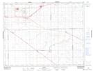
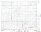
Maps showing McLean Recreation Site, 18-16-W2, Saskatchewan
McLean Recreation Site is a Conservation area located in 18-16-W2, Saskatchewan and has an elevation of 679 meters.
- Latitude: 50° 30' 9'' North (decimal: 50.5025284)
- Longitude: 104° 6' 33'' West (decimal: -104.1092195)
- Topography Feature Category: Conservation area
- Geographical Feature: Recreation Site
- Canadian Province/Territory: Saskatchewan
- Elevation: 679 meters
- Location: 18-16-W2
- Atlas of Canada Locator Map: McLean Recreation Site
- GPS Coordinate Locator Map: McLean Recreation Site Lat/Long
McLean Recreation Site NTS Map Sheets