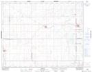
Maps showing Raymore Recreation Site, 1-29-19-W2, Saskatchewan
Raymore Recreation Site is a Conservation area located in 1-29-19-W2, Saskatchewan and has an elevation of 610 meters.
- Latitude: 51° 27' 17'' North (decimal: 51.4545983)
- Longitude: 104° 32' 25'' West (decimal: -104.5401850)
- Topography Feature Category: Conservation area
- Geographical Feature: Recreation Site
- Canadian Province/Territory: Saskatchewan
- Elevation: 610 meters
- Location: 1-29-19-W2
- Atlas of Canada Locator Map: Raymore Recreation Site
- GPS Coordinate Locator Map: Raymore Recreation Site Lat/Long